Crop Monitor for Early Warning
Report Information
No. 88: Published November 2nd, 2023
Conditions as of October 28th
For access to all reports, please visit the Archive.
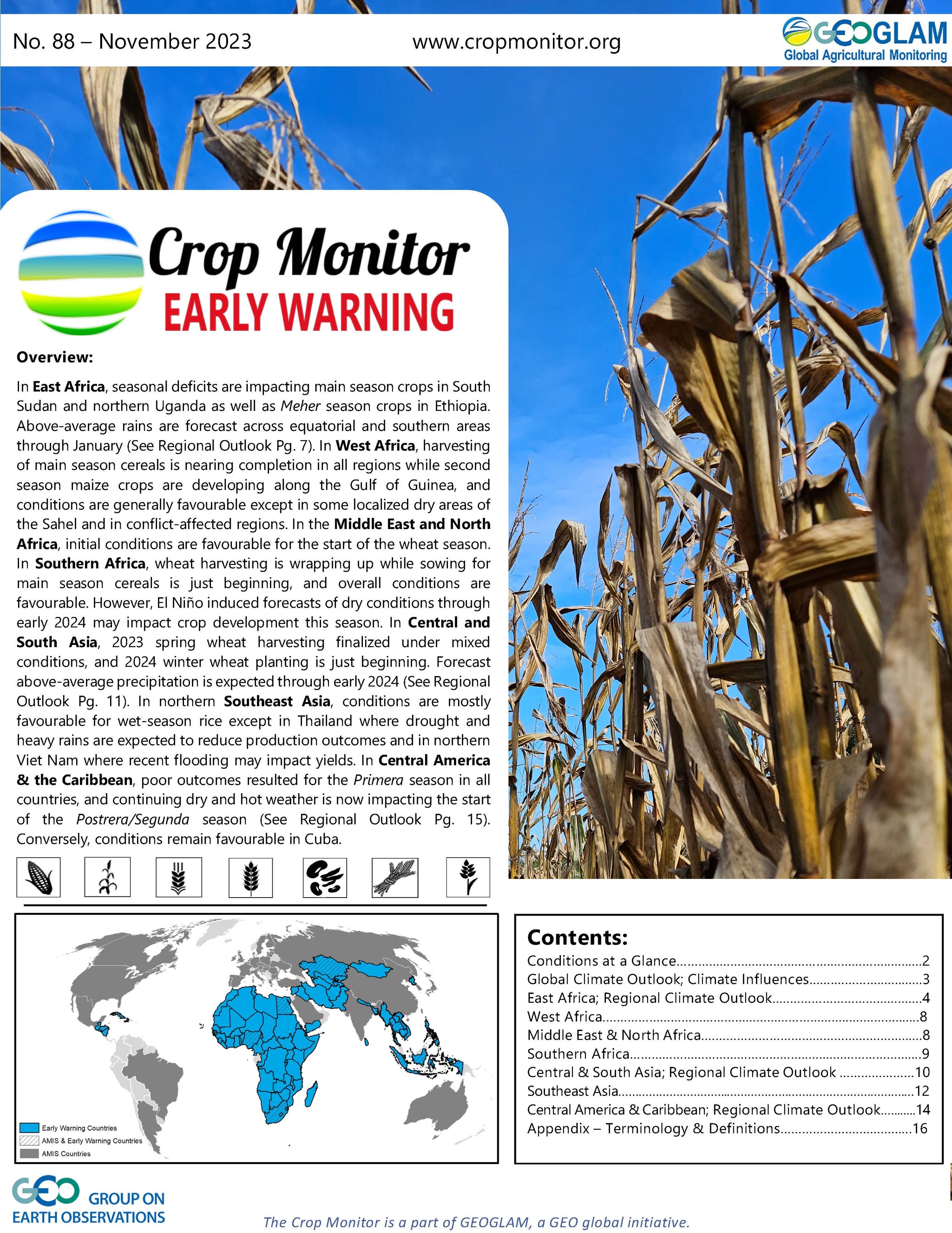
Overview
In East Africa, seasonal deficits are impacting main season crops in South Sudan and northern Uganda as well as Meher season crops in Ethiopia. Above-average rains are forecast across equatorial and southern areas through January (See Regional Outlook Pg. 7). In West Africa, harvesting of main season cereals is nearing completion in all regions while second season maize crops are developing along the Gulf of Guinea, and conditions are generally favourable except in some localized dry areas of the Sahel and in conflict-affected regions. In the Middle East and North Africa, initial conditions are favourable for the start of the wheat season. In Southern Africa, wheat harvesting is wrapping up while sowing for main season cereals is just beginning, and overall conditions are favourable. However, El Niño induced forecasts of dry conditions through early 2024 may impact crop development this season. In Central and South Asia, 2023 spring wheat harvesting finalized under mixed conditions, and 2024 winter wheat planting is just beginning. Forecast above-average precipitation is expected through early 2024 (See Regional Outlook Pg. 11). In northern Southeast Asia, conditions are mostly favourable for wet-season rice except in Thailand where drought and heavy rains are expected to reduce production outcomes and in northern Viet Nam where recent flooding may impact yields. In Central America & the Caribbean, poor outcomes resulted for the Primera season in all countries, and continuing dry and hot weather is now impacting the start of the Postrera/Segunda season (See Regional Outlook Pg. 15). Conversely, conditions remain favourable in Cuba.

Crop condition map synthesizing information for all Crop Monitor for Early Warning crops as of October 28th. Crop conditions over the main growing areas are based on a combination of inputs including remotely sensed data, ground observations, field reports, national, and regional experts. Regions that are in other than favourable conditions are labeled on the map with a symbol representing the crop(s) affected.
Crop Conditions at a Glance
EAST AFRICA: Persistent seasonal dryness continues to impact main season cereal harvesting in South Sudan, northern Uganda, and Ethiopia. Conversely, the likelihood for both a strong El Niño and peak positive IOD is expected to influence widespread well above-average seasonal rains into early 2024 (See Regional Outlook Pg. 7), likely benefitting crop development but posing a risk of flooding in low-lying and riverine areas.
WEST AFRICA: Harvesting of main season cereals is complete or nearing completion in all regions, and average to above-average rainfall throughout the season has been mostly conducive to crop production except in localized deficit areas along the Sahel as well as in conflict-affected regions.
MIDDLE EAST & NORTH AFRICA: Land preparation and limited planting are underway for the wheat crop, and initial conditions are favourable. In Egypt, rice and maize harvesting conditions are favourable.
SOUTHERN AFRICA: Wheat harvesting is nearing completion while planting of main season cereals is ramping up, and overall conditions are favourable. Below-average rainfall is forecast through January which may impact main season planting and establishment (See Climate Influences Pg. 3).
CENTRAL & SOUTH ASIA: Spring wheat harvesting for 2023 finalized under poor conditions in Kazakhstan and Kyrgyzstan due to persistent seasonal dryness. Winter wheat planting for harvest in 2024 is just beginning, and conditions are mixed with a strong probability of above-average precipitation into early 2024 (See Regional Outlook Pg. 11).
SOUTHEAST ASIA: In the north, harvesting of wet-season rice is underway, and conditions are generally favourable despite a dry trend early in the season, except in Thailand where conditions have been downgraded to poor and in areas of northern Viet Nam impacted by recent heavy rains and flooding. In the south, limited rains are impacting wet-season rice planting in Indonesia.
CENTRAL AMERICA & CARIBBEAN: Harvesting of Primera season cereals mostly finalized in September under poor conditions in all countries. Postrera/Segunda season maize and bean crops are in the vegetative to reproductive stage with concern due to continuing dry and hot weather. In Haiti, Printemps season rice harvesting finalized under poor conditions due to a limited availability of irrigation water.
Global Climate Outlook: Two-week forecast of areas of above or below-average precipitation
The two-week forecast (Figure 1) indicates a likelihood of above-average rainfall over much of the US, southern Mexico, Cuba, the Dominican Republic, southern Peru, southwestern Bolivia, northern Argentina, Uruguay, the southern tip of Brazil, the Gulf of Guinea countries, much of East Africa, northwestern parts of Southern Africa, Madagascar, Ireland, the United Kingdom, France, Belgium, the Netherlands, Germany, southern Norway, Sweden, Finland, Lithuania, Ukraine, Romania, Türkiye, much of the Middle East, Afghanistan, Pakistan, central and eastern parts of the Russian Federation, Mongolia, west and northeastern China, Sri Lanka, Japan, the Democratic People’s Republic of Korea, the Republic of Korea, Cambodia, and eastern Australia.
There is also a likelihood of below-average rainfall over much of Canada, central Mexico, Ecuador, Colombia, Venezuela, Guyana, Suriname, French Guiana, much of Brazil, northern Peru, Bolivia, Paraguay, Chile, Argentina, western parts of North Africa, Senegal, Gambia, Mali, Guinea-Bissau, Guinea, Sierra Leone, southern parts of Southern Africa, Portugal, Spain, central and Caucasus areas in the Russian Federation, Kazakhstan, Uzbekistan, Kyrgyzstan, Tajikistan, much of China, India, Bangladesh, Myanmar, Malaysia, Indonesia, Papua New Guinea, much of Australia, and New Zealand.

Figure 1: IRI SubX Precipitation Biweekly Probability Forecast for 4 – 17 November 2023, issued on 27 October 2023. The forecast is based on statistically calibrated tercile category forecasts from three SubX models. Source: IRI Subseasonal Forecasts Maproom
Climate Influences: Strong El Niño forecast through January and Positive IOD expected to cause regional climate impacts across much of the globe
The ongoing El Niño event will likely reach a strong level of intensity during November 2023 to January 2024 (75 percent chance), then weaken and remain active into March to May 2024 (80 percent chance), according to the IRI/CPC forecast.
El Niño events tend to enhance precipitation in Central Asia, southern North America, south-eastern South America, east and southern East Africa, and south-eastern China. Drier-than-average conditions tend to occur in Central America, northern South America, parts of the northern U.S. and Canada, Southern Africa, Northern China, the Maritime Continent, and Australia.
The ongoing positive Indian Ocean Dipole (IOD) event increased to a strong level of intensity during recent weeks. The IOD will likely remain positive through at least December, according to the Australian Bureau of Meteorology. These conditions tend to enhance the drying influences of El Niño in Australia and the Maritime Continent, and substantially increase the chances of a wet and intense East Africa short rains season. Source: UCSB Climate Hazards Center

Figure 1. Areas of dry and wet conditions during El Niño phase of ENSO. Source: NOAA & CHC & FEWS NET
East Africa


Crop condition map synthesizing Maize 1 crop conditions as of October 28th. Crop conditions over the main growing areas are based on a combination of inputs including remotely sensed data, ground observations, field reports, national, and regional experts. Conditions that are other than favourable are labeled on the map with their driver. For detailed description of the pie chart please see description box on the bottom of the page.
Across northern East Africa, harvesting of main season cereals is underway in the non-equatorial states of South Sudan and in Yemen while crops continue to develop in Sudan and Eritrea. A combination of conflict and related socio-economic challenges continue to disrupt agricultural production in Sudan, South Sudan, and Yemen. Persistent dryness has also degraded prospects in the non-equatorial states of South Sudan. In Ethiopia, harvesting of Meher season cereals continues under mixed conditions with ongoing concern in agricultural areas impacted by seasonal rainfall deficits, including in the southwest, centre, north-centre, and northeast, and in northern areas impacted by localized pockets of conflict and residual socio-economic challenges. Conversely, conditions remain favourable in the central west of Ethiopia where adequate rains were received.
Across southern East Africa, harvesting of main season cereals is nearing completion in unimodal areas of central and western Kenya and northeastern Uganda, with favourable outcomes expected in Kenya and poor outcomes expected in Uganda due to persistent dryness. Planting and development of second season maize and sorghum crops are underway in Uganda, Rwanda, Burundi, Kenya, and the United Republic of Tanzania with concern in most areas where residual dry soils from the previous season are impacting planting and crop establishment. However, there is a likelihood for improvement as the rains pick up and the season progresses. Conversely, in Somalia, high rainfall received in parts of the upstream areas of the southwest and from Ethiopia poses a risk of riverine flooding impacts to second season crops.
Throughout East Africa, there has been a mixed start of the October to December Deyr/Short Rains, though the rains are likely to be fully established by November in most equatorial regions. While rainfall and water resource deficits remain in some areas due to antecedent prolonged drought conditions, ongoing seasonal rains are expected to provide gradual improvement in the coming weeks. The likelihood for both a strong El Niño and peak positive IOD is expected to influence widespread well above-average seasonal rains into early 2024, with a high probability of exceeding the 80th percentile of rainfall for the November to January period (See Regional Outlook Pg. 7). The enhanced rains are expected to benefit recent deficit areas but also pose a risk of flooding in low lying and riverine areas, particularly from November through early 2024. Furthermore, temperatures are expected to be hotter than normal across most areas apart from some regions that will receive heavy rains and persistent cloudiness.
Northern East Africa & Yemen


Crop condition map synthesizing Sorghum 1 (left) and Maize 2 (right) conditions as of October 28th. Crop conditions over the main growing areas are based on a combination of inputs including remotely sensed data, ground observations, field reports, national, and regional experts. Conditions that are other than favourable are labeled on the map with their driver.
Across northern East Africa, harvesting of main season cereals is underway in the non-equatorial states of South Sudan and in Yemen while crops continue to develop in Sudan and Eritrea. A combination of conflict and related socio-economic challenges continue to disrupt agricultural production in Sudan, South Sudan, and Yemen. Persistent dryness has also degraded prospects in the non-equatorial states of South Sudan. In Ethiopia, harvesting of Meher season cereals continues under mixed conditions with ongoing concern in agricultural areas impacted by seasonal rainfall deficits, including in the southwest, centre, north-centre, and northeast, and in northern areas impacted by localized pockets of conflict and residual socio-economic challenges. Conversely, conditions remain favourable in the central west of Ethiopia where adequate rains were received.
Across southern East Africa, harvesting of main season cereals is nearing completion in unimodal areas of central and western Kenya and northeastern Uganda, with favourable outcomes expected in Kenya and poor outcomes expected in Uganda due to persistent dryness. Planting and development of second season maize and sorghum crops are underway in Uganda, Rwanda, Burundi, Kenya, and the United Republic of Tanzania with concern in most areas where residual dry soils from the previous season are impacting planting and crop establishment. However, there is a likelihood for improvement as the rains pick up and the season progresses. Conversely, in Somalia, high rainfall received in parts of the upstream areas of the southwest and from Ethiopia poses a risk of riverine flooding impacts to second season crops.
Throughout East Africa, there has been a mixed start of the October to December Deyr/Short Rains, though the rains are likely to be fully established by November in most equatorial regions. While rainfall and water resource deficits remain in some areas due to antecedent prolonged drought conditions, ongoing seasonal rains are expected to provide gradual improvement in the coming weeks. The likelihood for both a strong El Niño and peak positive IOD is expected to influence widespread well above-average seasonal rains into early 2024, with a high probability of exceeding the 80th percentile of rainfall for the November to January period (See Regional Outlook Pg. 7). The enhanced rains are expected to benefit recent deficit areas but also pose a risk of flooding in low lying and riverine areas, particularly from November through early 2024. Furthermore, temperatures are expected to be hotter than normal across most areas apart from some regions that will receive heavy rains and persistent cloudiness.
Southern East Africa & Yemen
In northeastern Uganda, harvesting of first season cereals is nearing completion under poor conditions as the poor performance of the June to September period likely affected crops at critical growth stages, and second season maize yields are also expected to be below-average despite heavy rains received in October. In bimodal rainfall areas, second season maize crops are developing under mixed conditions. Dry concerns are present in the west and center while crops in the east have received adequate rains for sufficient development. Additional El Niño induced precipitation is expected through early next year, posing a risk of waterlogging in riverine and wetland areas (See Regional Outlook Pg. 7). In Kenya, harvesting of Long Rains cereals is underway in the unimodal and major producing regions in the western half of the country under favourable conditions. In the bimodal and minor-producing eastern half of the country, planting of Short Rains maize crops is now underway, and residual dry conditions are impacting the start of the season, except along the coastal strip and Tana River areas. In Rwanda and Burundi, planting of Season A maize crops is underway, and mixed rainfall performance and distribution in October may impact planting progress and crop emergence. However, outlooks through January suggest increased and above-average precipitation amounts are likely (See Regional Outlook Pg. 7). In Burundi, access to fertilizer and seed inputs is also a challenge due to elevated costs. In Somalia, Deyr season planting is now underway with concern due to wet conditions in some south-central areas and dry conditions in the northwest. The onset of the Deyr rains has occurred, and precipitation levels are increasing. Already, significant heavy rains and flash flooding impacted Galmudug, Hirshabelle, Jubaland, and South West states in early October and resulted in displacements and relocations to higher grounds due to the risk of anticipatory riverine flooding, especially in Hirshabelle, Jubaland, and Galmudug states. However, vegetation conditions are suboptimal, and southernmost areas along the Lower Juba have not yet received adequate rains. There is a high probability of above-average rains during the remainder of the Deyr season (See Regional Outlook Pg. 7), and close monitoring will be necessary given the high risk of further riverine flooding during the peak rainfall period expected in November and into December, with potential impacts on irrigated agriculture. In the United Republic of Tanzania, planting of Masika season wheat and Vuli season maize is underway in bimodal areas of the north with concern regarding residual dry impacts from the preceding season.
Regional Outlook: Highly above-normal rainfall forecast for the next several months and through January 2024
Moderate-to-heavy rainfall (75 mm to > 150 mm) occurred during early-to-mid October in western and southern South Sudan, central and northwestern Uganda, central-western, southwestern, and southeastern Ethiopia, western Kenya, northwestern Tanzania, and portions of southern and central Somalia. Rains were lighter elsewhere, with typically dry conditions in northeastern Ethiopia and central and southern Tanzania. Highly above-average temperatures continued in many areas.
During recent weeks, sorghum and millet growing areas in southern Sudan and northern South Sudan continued to experience extreme high daytime temperatures. September to October 25th rainfall (Figure 1-left) was below-average in some of these areas (South Kordofan). Ethiopia’s former SNNPR region received heavy rains in late September and mid October—a major change from the persistent dryness in July and August—but this may not have benefitted harvesting in this region, and forecast heavy rains raise risks of landslides and flooding. Main season rainfall deficits in central-northern and central-eastern Ethiopia continued into mid-October due to low and below-average rainfall; these areas also experienced above-average temperatures.
Heavy, localized storms arrived in southeastern Ethiopia and Somalia in early-mid October. In Somalia, the storms led to flash floods, damages to roads and housing, and several deaths. According to the October 23rd OCHA Flash Update, “Preliminary reports by partners and community elders in Baidoa indicate that at least 122,000 people (20,347 families) have been affected by the rains and flash floods since 4 October, including 92,000 internally displaced people living in 178 settlements in the district.” Current GloFAS forecasts predict an increased likelihood of flooding along the Juba River during late October and early November, based on expected heavy rainfall. There will be ongoing concern about flood risks in the Juba, Shabelle, Genale Dawa, and Omo Gibe River catchments, and in low-lying areas in eastern and northern Kenya.
Above-normal rainfall is forecast across many areas during the two-week outlook period and during the next several months. An outlook for September 1st to November 10th illustrates the substantial rainfall predicted by GEFS from October 26th (Figure 1 middle-left). While outcomes in these locations will vary, there is a high level of confidence in wetter-than-average conditions in the region during late October to early November, based on similar ECMWF and the SubX predictions. Heavy, highly above-average rainfall is forecast across southern Ethiopia and in some central locations, as well as in Kenya, southern Somalia, and coastal northern Tanzania. Forecast unseasonal wet conditions in Ethiopia’s central, northern half, and Rift Valley regions raise some concern for possible adverse impacts to Meher season harvesting.
Above-normal rainfall is highly likely during November to January across equatorial and southern East Africa, based on the WMO (>70 % chances; Figure 1 middle-right), C3S, ICPAC, and other forecasts. The high odds, especially in eastern areas, come from the forecast influence of strong positive Indian Ocean Dipole (IOD) and El Niño conditions. In mid-October the IOD index reached high levels close to (though still lower than) the extreme positive IOD in 2019. Ongoing positive IOD conditions substantially raise the odds of highly above-average rainfall (> 80th percentile) in southern Ethiopia, Somalia, Kenya, and northeastern Tanzania, according to the NOAA PSL forecast (Figure 1-right). Forecast above-average rainfall is generally expected to have overall positive outcomes for agriculture, livestock reproduction, and food security in the region; however, there are also high risks of localized severe flooding in lowland and riverine areas, crop and livestock losses, infrastructure damage, displacement of affected populations, and infectious disease outbreaks.

Figure 1. September 1st to October 25th rainfall anomaly, September 1st to November 10th rainfall anomaly outlook, and 3-month probabilistic rainfall forecasts for November 2023 to January 2024. Left and middle-left: CHC Early Estimates, which compare current rainfall totals to the 1981-2022 CHIRPS average for their respective accumulation periods. These show the percent of average for Sep. 1st to Oct. 25th and for Sep. 1st to Nov. 10th, 2023. Preliminary data is used for Oct. 1st to 25th, and CHIRPS-GEFS forecast data is used for Oct. 26th to Nov. 10th. Middle-right: WMO probabilistic forecast for NDJ 2023-2024 precipitation terciles, based on models initialized in October, from the WMO Lead Centre Long-Range Forecast Multi-Model Ensemble. Right: Probabilistic forecast for the probability of NDJ 2023-2024 rainfall exceeding the 80th percentile, from the NOAA PSL hybrid prediction system using dynamical (C3S) and machine learning models. Source: UCSB Climate Hazards Center
West Africa

Crop condition map synthesizing crop conditions as of October 28th. Crop conditions over the main growing areas are based on a combination of inputs including remotely sensed data, ground observations, field reports, national, and regional experts. Crops that are in other than favourable conditions are labeled on the map with their driver.
In West Africa, harvesting of main season cereals is complete or nearing completion in all countries, including the Sahel countries of Mauritania, Senegal, Gambia, Guinea-Bissau, Mali, Burkina Faso, Niger, and Chad as well as the countries south of the Sahel including Guinea, Sierra Leone, Liberia, Cote d’Ivoire, Ghana, Togo, Benin, Nigeria, Cameroon, and the Central African Republic. Additionally, second season maize crops are in vegetative to reproductive stage along the Gulf of Guinea countries. This year, average to above-average rainfall throughout the season has been mostly conducive to crop production, and overall conditions remain favourable except in conflict-affected areas. Cumulative April to late-October deficits are registered in the Sahelian band, including in southeastern Mauritania to southwestern Mali, eastern Burkina Faso to western Niger, eastern Niger, and in the Sudano-Guinean zone, including in southern Mali, eastern Guinea to northwestern Cote d’Ivoire, central Nigeria, southern Chad, and southwestern Cameroon. However, the deficits are generally not expected to impact cropping outcomes. Only areas impacted by persistent conflict or socio-economic challenges are currently expected to see yield declines, including in central Mali, northern Burkina Faso, western Niger, northern Nigeria, western Chad, the Far North and Southwestern regions of Cameroon, and the Central African Republic. In Gambia, 2023 aggregate cereal production is forecast to be 16 percent above-average at 116 million tonnes due to an increase in planted area, the provision of subsidized fertilizers, and generally adequate weather outcomes despite dry spells in August and localized production shortfalls. In Benin, 2023 aggregate cereal production is forecast to be 9 percent above-average at 2.4 million tonnes due to an increase in planted area and conducive weather conditions throughout the season.
Middle East & North Africa
In the Middle East and North Africa, land preparation is underway for wheat crops, and the bulk of the planting will be carried out in November. In Egypt, harvesting is nearing completion for summer-season rice and maize crops while Nili season (Nile Flood) rice continues to develop for harvest from December, and overall conditions remain favourable.
Southern Africa

Crop condition map synthesizing wheat conditions as of October 28th. Crop conditions over the main growing areas are based on a combination of inputs including remotely sensed data, ground observations, field reports, national, and regional experts. Crops that are in other than favourable conditions are labeled on the map with their driver.
In Southern Africa, wheat harvesting continues under favourable conditions in Zimbabwe, Zambia, South Africa, and Lesotho, and the season will conclude in November and December. In South Africa, wet conditions during the winter supported production over the winter rainfall region and provided sufficient water supply over the irrigated interior. Forecast drier conditions for the remainder of the season are expected to support harvesting activities.
Planting of main season cereals is just beginning in Angola, Zambia, Zimbabwe, South Africa, eSwatini, and Lesotho, and initial conditions are favourable. Rainfall onset typically commences in October for the main summer growing season and occurs in November for most regions. The current strong El Niño suggests that parts of the region may experience below-average seasonal rainfall through early 2024, which may negatively influence planted area and crop performance (See Climate Influences Pg. 3). Furthermore, above-average temperatures are forecast for this period and may exacerbate dry conditions. Regions that experienced dry conditions and below-average yield outcomes in the previous season, including southern Angola, northern Namibia, parts of Zambia, and parts of Botswana, will need to be monitored closely.
In Angola, planting is now underway for main season cereals and planting activities will increase in November with the onset of seasonal rains. The Ministry of Agriculture is preparing to distribute agricultural inputs to households in productive regions that recently had a poor May to August Nacas growing season. In Zimbabwe, early planting is underway, and given the concerns around the current El Niño, the government is providing seeds and fertilizers in an effort to mitigate negative production outcomes. However, weakened currency and inflation will otherwise reduce farmers' ability to afford agricultural inputs and services this season. In South Africa, rainfall received over the far eastern areas in combination with anticipated precipitation in the coming days is expected to facilitate timely planting in these areas, aligning with the typical planting schedule. In Lesotho, the Ministry of Agriculture bought fertilizer and seeds to offer at reduced prices for the 2023/24 farming season, which is expected to boost farming activities and income for the start of planting. In the Democratic Republic of the Congo, planting and development of main season cereals continue with ongoing dry concerns in the north and favourable conditions elsewhere. Above-average rains are expected for the remainder of the year, which may help to ease deficits in the north.
Central & South Asia
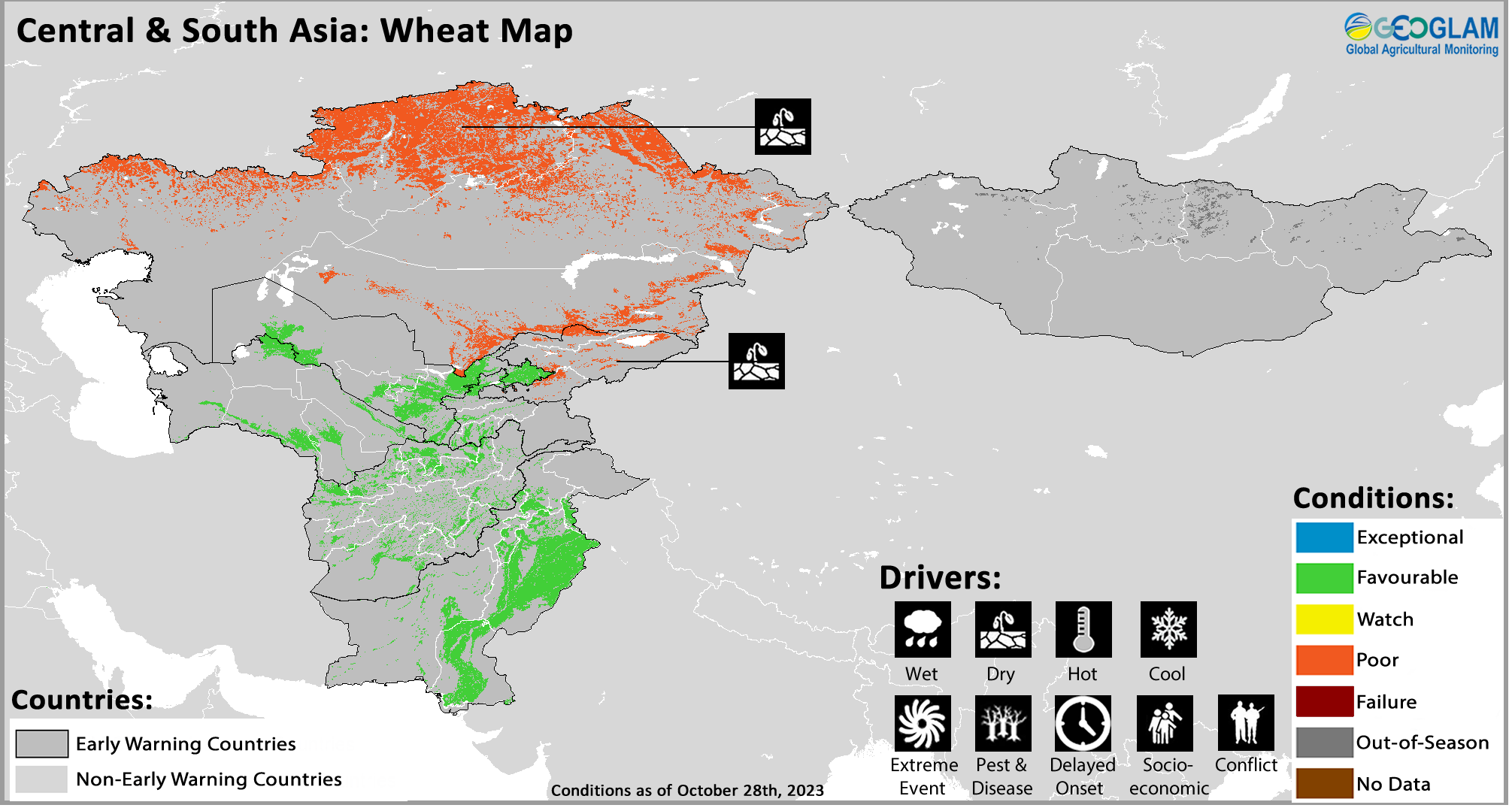
Crop condition map synthesizing wheat conditions as of October 28th. Crop conditions over the main growing areas are based on a combination of inputs including remotely sensed data, ground observations, field reports, national, and regional experts. Crops that are in other than favourable conditions are labeled on the map with their driver.
In Central and South Asia, 2023 spring wheat harvesting finalized under poor conditions in Kazakhstan and Kyrgyzstan due to persistent seasonal dryness while near-average yields resulted in Mongolia and Tajikistan. In Mongolia, harvesting of the mostly irrigated 2023 spring wheat crop ended in September, and production is forecast at an above-average level at 472 thousand tonnes as record high domestic prices and high demand resulted in a large sown area. In the major producing Central Region of Mongolia, favourable weather conditions and adequate irrigation supply resulted in average to above-average yields. Conversely, in the Western Region, poor June to August rainfall resulted in below-average yields in some minor producing provinces.
Winter wheat planting is now underway for harvest in 2024 in Turkmenistan, Uzbekistan, southern Kazakhstan, Kyrgyzstan, Tajikistan, Afghanistan, and Pakistan. Planting conditions are currently mixed with residual dryness in southern Kazakhstan and Kyrgyzstan. However, the current El Niño is associated with generally above-average precipitation into early 2024, which is expected to benefit both the winter and spring 2024 cropping seasons following previous dry conditions. Precipitation is also likely to be in the top 20 percent of historical records (See Regional Outlook Pg. 11), potentially indicating heavy rain or snowfall events, and above-average temperatures are expected for the same period. In Afghanistan, land preparation is underway, and planting of irrigated winter wheat has begun in some areas. Due to the long-lasting impacts of the three consecutive antecedent drought years, prevailing dry soil moisture conditions are prolonging the land preparation activities in some of the north and northeastern areas. Above-average precipitation forecast during the winter and early spring wet season is expected to benefit both winter and spring wheat planting and development processes, result in above-average snow water volumes, and replenish groundwater levels in many basins. However, a strong probability of both high precipitation amounts and hot temperatures into early 2024 is likely to result in atypically rapid snow melting and high flooding for the March-April-May period (See Regional Outlook Pg. 11). Furthermore, maize and rice harvesting have begun, and production is expected to be below-average as a result of insufficient surface water levels and groundwater supply for irrigation. In Pakistan, Kharif season rice and maize harvesting is underway, and conditions remain favourable. Planting of the Rabi season wheat crop, which is almost entirely irrigated, is just beginning under favourable conditions with adequate soil moisture in the main producing Punjab and Sindh provinces. Planted area is forecast at an above-average level of 9 million tonnes, driven by record domestic prices and strong local demand. Above-average irrigation water availability in the main reservoirs is expected to benefit yields. Furthermore, a high likelihood of above-average precipitation through March 2024 is expected to positively impact Rabi season outcomes and increase irrigation water availability for the 2024 Kharif season rice and maize crops.
Regional Outlook: Elevated chances of above-normal rainfall across much of the region through March 2024
October marks the beginning of the fall rainy season in Central and Southern Asia, although precipitation amounts for much of the region tend to be small (< 50 mm) for the first month. The start to this year’s season was generally average throughout the region, with dry conditions in the southwest (e.g., southern Iran and southwestern Afghanistan), and larger, near-average amounts of 5-50 mm in northwestern Iran, Turkmenistan, central and northern Afghanistan, Pakistan, and Uzbekistan. Portions of western Kazakhstan and southern Jammu and Kashmir received slightly above-average precipitation, while Kyrgyzstan received slightly below-average precipitation. Precipitation is expected to increase in November, and totals for October 1st to November 10th will likely be above-average in Kazakhstan, below-average in Kyrgyzstan and Tajikistan, and near-average elsewhere (Figure 1-left). GEFS and ECMWF extended range forecasts from October 31st indicate drier-than-average conditions through mid-November in central areas and locations in northern Afghanistan.
There are elevated chances of above-normal fall and winter precipitation across the region associated with El Niño. This is also indicated by multi-model ensemble forecasts for November 2023 to March 2024, including the WMO (Figure 1-right), NMME, and the C3S. The WMO forecasts at least a 50% chance of above-normal precipitation across southern and central areas, and higher-than 70% chances in northern Afghanistan, eastern Uzbekistan, and western Tajikistan. Above-normal temperatures are also forecast through May.
These forecasts support overall optimistic outlooks for winter wheat, for spring crop planting activities, and for improved surface water and groundwater levels. Above-average temperatures will also increase springtime flooding risks related to faster snowmelt and higher chances of precipitation in the form of intense rain. Above-average precipitation may increase the threat of locust invasions into wheat production areas in 2024 and may also increase the chance of Yellow wheat Rust. While the early fall precipitation to-date does not indicate a poor start to planting itself, there could be residual impacts on those activities from the three-year drought in Afghanistan, such as from irrigation constraints and from below-average root zone soil moisture in portions of northern Afghanistan, as of October 26th.

Figure 1. A seasonal rainfall outlook and a 5-month probabilistic precipitation forecast.
Left: A CHC Early Estimate comparing Oct. 1st to Nov. 10th, 2023 precipitation totals to the 1981-2022 CHIRPS average. The current season total is based on CHIRPS Preliminary data for Oct. 1st to Oct. 25th and a CHIRPS-GEFS forecast for Oct. 26th to Nov. 10th. Right: WMO probabilistic forecast for November 2023 to March 2024 precipitation tercile, based on models initialized in October. From the WMO Lead Centre Long-Range Forecast Multi-Model Ensemble. Source: UCSB Climate Hazards Center
Southeast Asia


Crop condition map synthesizing rice conditions as of October 28th. Crop conditions over the main growing areas are based on a combination of inputs including remotely sensed data, ground observations, field reports, national, and regional experts. Crops that are in other than favourable conditions are labeled on the map with their driver.
In southern Southeast Asia, including Indonesia, Malaysia, and Brunei, dry-season rice is in the harvesting stage under favourable conditions. Planting of wet-season rice is now underway, but progress is slow due to limited rainfall received, particularly in southern Indonesia. In northern Southeast Asia, wet-season rice is in the late growing to harvesting stage. Despite dryness early in the growing season, yields are expected to be mostly near-normal due to adequate rainfall received later in the season, except in Thailand and northern Viet Nam. In Thailand, final production outcomes are expected to be poor as the country was severely affected by drought through much of the season that reduced planted area as well as damage from heavy rains in September and October. Other countries were also impacted by heavy rains and flooding during the same period, but the damage was not generally severe except in northern Viet Nam. Elsewhere in Southeast Asia, conditions are generally favourable except in Nepal where there is concern for potential rice yield declines due to insufficient rainfall received as well as high input costs.
In Indonesia, dry-season rice planted in irrigated fields, such as in the northern regions of Java and Bali, in August and September is developing under favourable conditions. Harvesting activities for dry-season rice continued into the fourth month with a total harvested area of 3.2 million hectares which is 4.9 percent lower than last year, and yield is also expected to be slightly lower than last year due to the influence of drought. While the rainy season typically commences across most provinces in October, distribution is uneven due to the impacts of a strong El Niño. Rainfall received in late September and early October improved water shortages in Sumatra and Sulawesi. Some regions are still experiencing drought conditions, but there is currently not a significant impact to dry-season rice development. Wet-season rice planting has commenced but is progressing at a slow pace due to limited rainfall received and resulting water shortages, particularly in the south. In Malaysia, harvesting of dry-season rice is nearing completion under favourable conditions with sufficient sunlight received during the growing season. Total harvested area is expected to be 264 thousand hectares with a yield of 3.7 tons per hectare. October marked the third month of wet-season rice planting, and the early growing conditions are favourable due to sufficient rainfall received. Total planted area reached 31 thousand hectares as of September, which is slower than a typical year as a result of heavy rains in the northern part of Peninsular Malaysia, the main rice production area. In Brunei, harvesting of dry-season rice is nearing completion with a favourable yield of around 3.54 metric tons per hectare, which is 25 percent higher than the previous dry season as a result of conducive weather during the growth stages, adequate irrigation water supply, and the cultivation of hybrid rice varieties. In rainfed areas, transplanting of wet-season rice began in September with adequate precipitation received. In irrigated areas, land preparation is underway. Forecast hot temperatures and heavy rainfall this season suggest a risk of pests and diseases, as well as potential flash flooding in low-lying areas.
In the Philippines, wet-season rice planted from July to August is in the heading to flowering stage under favourable conditions. In the second half of September, two tropical cyclones passed through the country, enhancing the southwest monsoon and bringing heavy rains to some parts of Luzon, but there was no significant damage to rice development. However, forecast below-normal rainfall conditions in most parts of Luzon and Eastern and Western Visayas may impact crops. In Thailand, wet-season rice is in the grain filling stage, and conditions have been downgraded to poor due to the impacts of drought early in the season as well as later flooding. Drought conditions resulted in a 1.45 percent decrease in planted area compared to the previous year, and heavy rainfall in many areas during September and October resulted in prolonged flooding in the rice fields. About 128 thousand hectares of crops were damaged in Northern, Northeastern, and Central regions. Both yield and total production are expected to decrease compared to average. Furthermore, rainfall outcomes during the coming months will be critical to support the current wet-season crop and ensure adequate water reserves for the dry-season crop. In northern Viet Nam, both the main wet-season (seasonal) and other wet-season (summer-autumn) rice is in the grain filling stage, and some provinces have started to harvest. Conditions have been downgraded to watch due to heavy rain and flooding in the central region in late September, and yields are expected to decrease. In the south, harvesting of the main wet-season (summer-autumn) rice is now complete with an average estimated yield of 5.89 tons per hectare and 3.4 percent higher than last year due to favourable weather as well as advances in rice varieties. The other wet-season (autumn-winter and seasonal) rice is in the grain filling to harvesting stage under favourable conditions. In Laos, wet-season rice is in the grain filling to early harvesting stage under favourable conditions. In lowland areas, conducive weather and sunlight levels received throughout the season benefitted paddy fields. Final planted area is 805 thousand hectares, which is 106 percent of the national production plan, and 15 percent of the planted area has been harvested. In upland areas, final planted area is 101 thousand hectares, and 18 percent of the planted area has been harvested. In Myanmar, wet-season rice is in the growing to grain filling stage under favourable conditions. Planting activities have concluded with an area of 6.03 million hectares accounting for 99.5 percent of the national plan. Additionally, harvesting of earlier planted crops is underway. Over 51 thousand hectares have been harvested, producing 210 thousand tons of paddy with a yield of 4.1 tons per hectare, which is slightly higher than last year. However, heavy rains in October affected over 40 thousand hectares in localized areas of the Delta Region, particularly in Bago and Yangon, representing a significant loss of crop production for these areas with a potential loss to total production at the national scale. In Cambodia, planting of wet-season rice is nearing completion, and conditions remain favourable. Total planted area is 2.8 million hectares, a 4 percent increase from last year. However, heavy rains and flooding affected 1.5 percent of the planted area in central and western coastal regions and damaged 17 percent of the affected area. The government is distributing seeds for re-seeding during the next season. Harvesting of earlier planted crops is underway, and 62 percent of rice was harvested with a current yield of 4 tons per hectare, which is slightly higher than last year.
In Sri Lanka, harvesting of Yala season rice and maize finalized under favourable conditions. However, aggregate 2023 production is estimated at a below-average level for a second consecutive year as a result of lingering effects of reduced agrochemical application and localized unfavourable weather outcomes. Planting of Maha season rice and maize is just beginning under favourable conditions with adequate soil moisture, except in localized areas of the north where rains are below-average. While the southwest monsoon typically brings rain from May to August, and intensification in October has resulted in heavy rainfall in the Western, Sabaragamuwa, and Southern provinces. In Nepal, rice crops, the country’s main staple, are in vegetative to reproductive stage for harvest from November, and there is concern for potential yield declines due to insufficient rainfall received as well as high input costs. Both rice and maize production are expected at a below-average level. Conversely, wheat planting is just beginning under favourable conditions with adequate soil moisture. In Bangladesh, Aman season rice as well as sorghum crops are developing for harvest from November, and conditions remain favourable. The Aman paddy crop is almost entirely rainfed and accounts for 35 percent of annual output, and production is forecast at a bumper level as a result of increased sown area, high domestic prices, good yields following favourable weather outcomes, the application of subsidized fertilizer and pesticides, and sufficient irrigation water availability. In the Democratic People’s Republic of Korea, rice harvesting finalized in October under favourable conditions due to generally conducive weather outcomes this season.
Central America & Caribbean


Crop condition map synthesizing Postrera season Bean conditions as of October 28th. Crop conditions over the main growing areas are based on a combination of inputs including remotely sensed data, ground observations, field reports, national, and regional experts. Conditions that are other than favourable are labeled on the map with their driver.
In Central America, harvesting of Primera season cereals finalized in September under poor conditions in all countries, and smallholder and subsistence farmers were especially impacted. Conversely, in Honduras, rice harvesting is underway, and there has been an improvement in expected yield outcomes due to enhanced October rains. Postrera/Segunda season maize and bean crops are in vegetative to reproductive stage with concern across Guatemala, El Salvador, Honduras, and Nicaragua due to continuing dry and hot weather, with a seasonal progress delay of approximately 15 days. During the last three months, below-average rains persisted across much of Central America, especially along the border of Honduras and Nicaragua and in Petén department located in northern Guatemala. While some areas received high rainfall amounts over a short time period that helped to reduce deficits, it was not sufficient to support the normal development of crops. Additionally, above-average temperatures over Central America, with records exceeded in many regions, exacerbated the dry conditions and reduced soil moisture levels (See Regional Outlook Pg. 15). Many subsistence farmers are still waiting for adequate soil moisture to begin planting, and large farmers are experiencing issues related to a lack of irrigation water supply. Generally, below-average and irregular rainfall and high temperatures are expected to continue through the end of the Postrera cycle in November and December and into February 2024, and negative yield impacts are expected. Conversely, above-average rains in recent weeks led to flash flooding in southern Guatemala as well as in the Gulf of Fonseca region, which is expected to receive above-average precipitation through February. In areas that are able to plant for the Postrera/Segunda season, this may impact bean crops which are sensitive to high rainfall amounts. Furthermore, as of late October, Tropical Storm Pilar has intensified and is expected to near the Central American Pacific coast and may increase to near hurricane strength (See Regional Outlook Pg. 15). The storm has already caused persistent rainfall in areas of El Salvador, Honduras, and Nicaragua facing the Pacific coast, and El Salvador’s president declared a state of emergency regarding expected heavy rains and flooding along the country’s coast.
In Honduras, harvesting of main season rice is nearing completion while second season rice crops, which are predominantly irrigated, continue to develop for harvest from December. Above-average rains in early October in the key paddy producing provinces of Comayagua and Intibucá may have contributed to increased moisture content for crops about to be harvested, which could negatively impact yields. However, the rains were likely beneficial for main season crops that were planted later than normal and for irrigated second season crops that are still developing. In Nicaragua, below-average rainfall is expected to persist over Apante producing areas from December to February, likely impacting the Apante crop production which supports markets in Honduras, El Salvador, and Costa Rica. Rainfall distribution outcomes through early next year will be critical for adequate crop development. In Haiti, Printemps season rice harvesting finalized under poor conditions as a result of late and below-average rains at the beginning of the season that resulted in limited availability of irrigation water supply and a subsequent yield decline. Harvesting of Été season maize and bean crops is now underway and will finalize in November, and a combination of delayed and below-average rains and hot temperatures is expected to result in yield declines. The last two months have resulted in increased deficits over southern areas. However, rainfall is expected to return to average levels through the end of the year, and temperatures are also expected to be above-average (See Regional Outlook Pg. 15). In Cuba, harvesting of main season maize and second season rice continues under favourable conditions, and the season will conclude in November.
Regional Outlook: Heavy rain expected across parts of the region in early November followed by forecast below-average precipitation and above-average temperatures through February 2024
Below-average rainfall and above-average temperatures continued during recent weeks. Average maximum temperatures were several degrees higher than normal (Figure 1-left), with a prolonged heat wave during late September into early October. In eastern Honduras, very high temperatures continued into mid-October. Much drier-than-average conditions occurred during late September to late-October in central, eastern, and northern Guatemala, northern and southeastern Honduras, central-northern and northeastern Nicaragua, and southwestern Haiti, based on preliminary rainfall estimates. Rainfall was above-average in some locations– in southwest Guatemala, the Gulf of Fonseca region, and in parts of central Honduras, northwestern Nicaragua, and eastern Haiti.
Across the region, large rainfall deficits developed during this season and many areas were impacted by recurring dry spells and hot conditions. Rainfall totals for August 1st to October 25th range from 60% to 90% of average in many areas (Figure 1 middle-left). Severe seasonal drought conditions are in northern and eastern Guatemala, northeastern and southeastern Honduras, and northern Nicaragua. Forecast rainfall could improve seasonal totals in Honduras and Nicaragua. However, positive impacts on Postrera crops are not expected due to adverse growing conditions and since harvesting typically occurs in November. Associated with Tropical Storm Pilar, which is bringing heavy rain to coastal Guatemala and El Salvador, and the forecast potential development of a tropical storm in the western Caribbean Sea this week, forecast highly above-average rainfall (Figure 1 middle-right) could result in dangerous flooding and landslides.
There are concerns for potential irregular and below-normal rainfall during Nicaragua’s Apante season– an important season for bean production and regional markets. Long-range forecasts vary, but the elevated chances of below-normal December 2023 to February 2024 rainfall forecast by the WMO (Figure 1 right) and the NMME, and dry outcomes during some previous El Niño seasons, are all reasons to be on watch. Above-normal temperatures will likely continue.

Figure 1. A seasonal maximum temperature anomaly, seasonal rainfall anomaly, a 15-day precipitation forecast, and a 3-month probabilistic rainfall forecast. Left: Mean September 21st to October 20th, 2023 pentadal maximum temperature (Tmax) anomalies, relative to the 1991-2020 average; from the experimental CHIRTSmax-ERA5 dataset. Middle-left: Percent of average rainfall for Aug. 1st to Oct. 25th, 2023, based on CHIRPS preliminary data for Oct. 1st to 25th and a 1981-2022 baseline. Middle-right: A 15-day CHIRPS-GEFS forecast for rainfall anomaly for Oct. 31st - Nov. 14th. Right: WMO probabilistic forecast for Dec. 2023 to Feb. 2024 precipitation tercile, based on models initialized in October. From the WMO Lead Centre Long-Range Forecast Multi-Model Ensemble. Source: UCSB Climate Hazards Center
Pie Chart Description: Each slice represents a country’s share of total regional production. The proportion within each national slice is colored according to the crop conditions within a specific growing area; grey indicates that the respective area is out of season. Sections within each slide are weighted by the sub-national production statistics (5-year average) of the respective country. The section within each national slice also accounts for multiple cropping seasons (i.e. spring and winter wheat) and are a result of combining totals from multiple seasons to represent the total yearly national production. When conditions are other than favourable icons are added that provide information on the key climatic drivers affecting conditions.
Information on crop conditions in the main production and export countries can be found in the Crop Monitor for AMIS, published November 2nd, 2023.
Sources and Disclaimers: The Crop Monitor assessment is conducted by GEOGLAM with inputs from the following partners FEWS NET, JRC, WFP, ARC, AFSIS, MESA, ICPAC, FAO GIEWS, Applied Geosolutions and UMD. The findings and conclusions in this joint multi-agency report are consensual statements from the GEOGLAM experts, and do not necessarily reflect those of the individual agencies represented by these experts.
More detailed information on the GEOGLAM crop assessments is available at www.cropmonitor.org